![](/images/other/stat-length.png)
![Randonnée Marche Le Pouliguen - La grande côte - Le Pouliguen - Photo](https://media.geolcdn.com/t/1900/400/ext.pjpeg?maxdim=2&url=https%3A%2F%2Fstatic1.geolcdn.com%2Fsiteimages%2Fupload%2Ffiles%2F1553511878bg_sport_marche.png)
La grande côte - Le Pouliguen
jylera
Utilisateur
![Longueur](/images/other/stat-length.png)
Longueur
8,7 km
![Altitude max](https://static1.geolcdn.com/siteimages/upload/files/1508320355ic_sort_altitude_max_24dp.png)
Altitude max
17 m
![Dénivelé positif](https://static1.geolcdn.com/siteimages/upload/files/1508320355ic_sort_den_pos_24dp.png)
Dénivelé positif
54 m
![Km-Effort](/images/other/stat-length.png)
Km-Effort
9,4 km
![Altitude min](https://static1.geolcdn.com/siteimages/upload/files/1508320355ic_sort_altitude_min_24dp.png)
Altitude min
0 m
![Dénivelé négatif](https://static1.geolcdn.com/siteimages/upload/files/1508320355ic_sort_den_neg_24dp.png)
Dénivelé négatif
53 m
![Boucle](https://static1.geolcdn.com/siteimages/upload/files/16400158638029165_repeat_loop_refresh_sync_direction_icon.png)
Boucle
Oui
Date de création :
2016-11-10 00:00:00.0
Dernière modification :
2016-11-10 00:00:00.0
![Marche](https://static1.geolcdn.com/sitytour/trail-icons/101.png)
2h08
Difficulté : Facile
![Scannez ce code QR pour ouvrir la randonnée dans l'application SityTrail](https://capi.geolives.com/qq0zvz2zws4bq2lad0pu/sitytour/trails/238066/qr.png?size=200)
Application GPS de randonnée GRATUITE
À propos
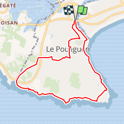
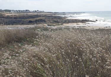
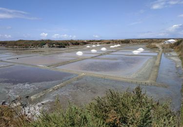
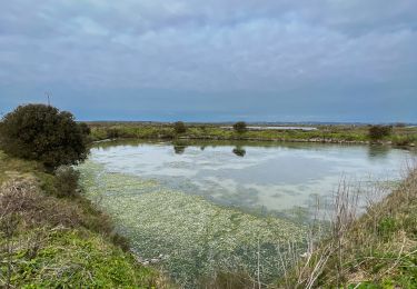
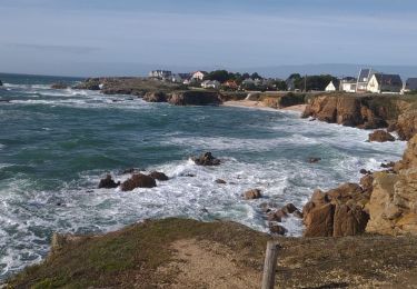
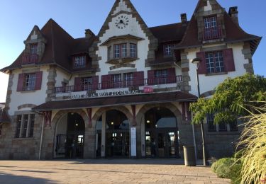
Randonnée Marche de 8,7 km à découvrir à Pays de la Loire, Loire-Atlantique, Le Pouliguen. Cette randonnée est proposée par jylera.
Description
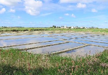
Attention, la partie entre les points 1 et 2 n'est praticable qu'à marée basse ! Si la mer monte, il y a une variante intérieure.
Localisation
Pays :
France
Région :
Pays de la Loire
Département/Province :
Loire-Atlantique
Commune :
Le Pouliguen
Localité :
Unknown
Départ:(Dec)
Départ:(UTM)
543242 ; 5236256 (30T) N.
Commentaires
Randonnées à proximité
![Randonnée Marche Batz-sur-Mer - Marais Salants de Batz sur Mer - Photo](https://media.geolcdn.com/t/375/260/0cbedef9-4727-4a02-9453-781bf1178122.jpg&format=jpg&maxdim=2)
![Marche Marche](https://static1.geolcdn.com/sitytour/trail-icons/101.png)
Marais Salants de Batz sur Mer
Marche
Facile
Batz-sur-Mer,
Pays de la Loire,
Loire-Atlantique,
France
![](/images/other/stat-length.png)
3,2 km | 3,2 km-effort
43min
![](https://static1.geolcdn.com/siteimages/upload/files/16400158638029165_repeat_loop_refresh_sync_direction_icon.png)
Oui
![Randonnée Marche La Baule-Escoublac - gare de Pornichet - Photo](https://media.geolcdn.com/t/375/260/ext.jpg?maxdim=2&url=https%3A%2F%2Fservices.sitytrail.com%2FGeolivesWS%2FDownloadMedia.ashx%3FTrailID%3D993054%26Media%3D20180624205634.jpg)
![Marche Marche](https://static1.geolcdn.com/sitytour/trail-icons/101.png)
gare de Pornichet
Marche
Très facile
La Baule-Escoublac,
Pays de la Loire,
Loire-Atlantique,
France
![](/images/other/stat-length.png)
6,1 km | 6,9 km-effort
1h 25min
![](https://static1.geolcdn.com/siteimages/upload/files/16400158638029165_repeat_loop_refresh_sync_direction_icon.png)
Oui
![Randonnée Trail Le Pouliguen - Plage de Nau-bout de Batz(18.5K 80D+) - Photo](https://media.geolcdn.com/t/375/260/6e876028-a079-49ae-b59a-7dbf260e65a6.jpg&format=jpg&maxdim=2)
![Trail Trail](https://static1.geolcdn.com/sitytour/trail-icons/104.png)
Plage de Nau-bout de Batz(18.5K 80D+)
Trail
Moyen
Le Pouliguen,
Pays de la Loire,
Loire-Atlantique,
France
![](/images/other/stat-length.png)
18,7 km | 20 km-effort
2h 19min
![](https://static1.geolcdn.com/siteimages/upload/files/16400158638029165_repeat_loop_refresh_sync_direction_icon.png)
Oui
![Randonnée Marche Batz-sur-Mer - batz sur mer - Photo](https://media.geolcdn.com/t/375/260/3dd8e1cb-5e84-415d-9c6f-ae9534d5eb1e.jpg&format=jpg&maxdim=2)
![Marche Marche](https://static1.geolcdn.com/sitytour/trail-icons/101.png)
batz sur mer
Marche
Moyen
Batz-sur-Mer,
Pays de la Loire,
Loire-Atlantique,
France
![](/images/other/stat-length.png)
7,8 km | 8,5 km-effort
2h 47min
![](https://static1.geolcdn.com/siteimages/upload/files/16400158638029165_repeat_loop_refresh_sync_direction_icon.png)
Oui
![Randonnée V.T.C. Guérande - 2023-07-25 Marais salants de Guérande - Photo](https://media.geolcdn.com/t/375/260/0a56980d-e337-4fe5-a1ee-9b7bab486125.jpg&format=jpg&maxdim=2)
![V.T.C. V.T.C.](https://static1.geolcdn.com/sitytour/trail-icons/203.png)
2023-07-25 Marais salants de Guérande
V.T.C.
Difficile
Guérande,
Pays de la Loire,
Loire-Atlantique,
France
![](/images/other/stat-length.png)
32 km | 33 km-effort
2h 9min
![](https://static1.geolcdn.com/siteimages/upload/files/16400158638029165_repeat_loop_refresh_sync_direction_icon.png)
Oui
![Randonnée Marche Batz-sur-Mer - Marais Salants de Batz sur Mer - Photo](https://media.geolcdn.com/t/375/260/b0e69f99-c0f4-4a9f-a193-7612a2406b47.jpeg&format=jpg&maxdim=2)
![Marche Marche](https://static1.geolcdn.com/sitytour/trail-icons/101.png)
Marais Salants de Batz sur Mer
Marche
Très facile
Batz-sur-Mer,
Pays de la Loire,
Loire-Atlantique,
France
![](/images/other/stat-length.png)
4,4 km | 4,4 km-effort
1h 8min
![](https://static1.geolcdn.com/siteimages/upload/files/16400158638029165_repeat_loop_refresh_sync_direction_icon.png)
Oui
![Randonnée V.T.T. Guérande - Le Croisic - Photo](https://media.geolcdn.com/t/375/260/3c586856-2120-4198-84d3-f552da8ad210.jpg&format=jpg&maxdim=2)
![V.T.T. V.T.T.](https://static1.geolcdn.com/sitytour/trail-icons/202.png)
Le Croisic
V.T.T.
Facile
Guérande,
Pays de la Loire,
Loire-Atlantique,
France
![](/images/other/stat-length.png)
30 km | 32 km-effort
2h 59min
![](https://static1.geolcdn.com/siteimages/upload/files/16400158638029165_repeat_loop_refresh_sync_direction_icon.png)
Oui
![Randonnée Marche La Baule-Escoublac - gare La Baule Escoubac - Photo](https://media.geolcdn.com/t/375/260/ext.jpg?maxdim=2&url=https%3A%2F%2Fservices.sitytrail.com%2FGeolivesWS%2FDownloadMedia.ashx%3FTrailID%3D994300%26Media%3D20180626202507.jpg)
![Marche Marche](https://static1.geolcdn.com/sitytour/trail-icons/101.png)
gare La Baule Escoubac
Marche
Très facile
La Baule-Escoublac,
Pays de la Loire,
Loire-Atlantique,
France
![](/images/other/stat-length.png)
5,1 km | 5,7 km-effort
1h 2min
![](https://static1.geolcdn.com/siteimages/upload/files/16400158638029165_repeat_loop_refresh_sync_direction_icon.png)
Oui
![Randonnée Marche Guérande - Guérande_Careil - Photo](https://media.geolcdn.com/t/375/260/ext.jpg?maxdim=2&url=https%3A%2F%2Fservices.sitytrail.com%2FGeolivesWS%2FDownloadMedia.ashx%3FTrailID%3D415908%26Media%3D52a60e6b-5068-4f71-b8f3-923b38638fa7.jpg)
![Marche Marche](https://static1.geolcdn.com/sitytour/trail-icons/101.png)
Guérande_Careil
Marche
Moyen
Guérande,
Pays de la Loire,
Loire-Atlantique,
France
![](/images/other/stat-length.png)
13,5 km | 14,8 km-effort
4h 0min
![](https://static1.geolcdn.com/siteimages/upload/files/16400158638029165_repeat_loop_refresh_sync_direction_icon.png)
Oui